|
HiWING Mechanical & Electrical Technology Corp ,
|
Gold Index: 9761
Geological Hazard Disaster Monitoring System / Disaster Alert System
| Place of Origin: | Guangdong, China (Mainland) |
|
|
|
| Add to My Favorites | |
| HiSupplier Escrow |
Product Detail
Geological Hazard Disaster Monitoring System / Disaster Alert System
<span style="font-family:arial,he
Geological Hazard Disaster Monitoring System / Disaster Alert System
Beidou satellite navigation Disaster Monitoring System for forecasting debris-flow
The regional geological hazard monitoring system(with the function of early warning and forecasting of disasters such as collapse, landslip and debris-
flow; supporting wire communication and such wireless communications as GPRS and
Beidou satellite navigation; and remote monitor and management of on-site equipment.)
The regional geological disaster monitoring system
Key words: geological hazard monitoring system
early alarm and forecasting of disasters
The regional geological hazard monitoring system is an integrated system to monitor space, ground surface and underground area through data collection, transmission, analysis and treatment. It can establish a monitoring network covering air, ground surface and underground, i.e. the so-called “three-net”.The system makes full use of geological parameters collected by high precision inertial sensor in sensitive rock soil, such as subtle displacement, distortion, and vibration, and combines them with ground or underground parameters collected by other sensors such as temperature, electric resistance and rainfall. Then before any hazard happens, it automatically gathers such feature information, transmits it via network to the database for storage and carries out processing and analysis. Thus it can realize distributed sharing of geological data in a region and even the whole country.
Feature
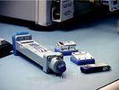
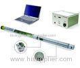
It supports integration with many common monitoring sensors to realize automatic monitoring, such as fixed inclinometer, udometer, crack displacement meter, pore water pressure meter, soil pressure meter and so on.
It has flexible working manner, and supports timed reporting, real-time measurement, threshold startup and some other modes.
It supports wire communication and such wireless communications as GPRS, Beidou satellite navigation and digital transmission radio.
It can remotely monitor and manage the on-site equipment.
With linked responding of on-site monitoring sensor, it can realize triggering of related sensors by one sensor.
Advanced technology
Standardized and modular design, leading to flexible networking and high expandability.
Adaptability to all-weather outdoor environment, and high reliability.
Low power consumption and allowing diversified power supplies.
Comprehensive data processing and output in various charts and forms; database retrieval by landmark, time, parameter type and so on; dynamic WEB release.
Sound-light alarm and short message alarm.
Application fields
It helps to estimate and judge the change trends of hazard factors such as landslip and mudflow which realizes early alarm and forecasting of disasters.
Domestic and international cooperation projects
Lishan automatic landslip monitoring project of Xi’an City.
Geological hazard monitoring project of Longnan City, Gansu Province.
Related Search
Find more related products in following catalogs on Hisupplier.com

Company Info
HiWING Mechanical & Electrical Technology Corp , [China (Mainland)]
Business Type:Manufacturer
City: Beijing
Province/State: Beijing
Country/Region: China (Mainland)


